LiDAR stories
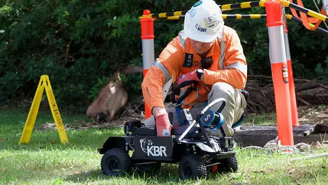
Central Coast Council deploys remote vehicle for record sewer scan
This month
#
lidar
#
3d scanning
#
public infrastructure
Central Coast Council used a remote-controlled vehicle with LiDAR and 360° CCTV to scan a 640m sewer stretch, enhancing safety and efficiency in inspections.

PiLogic secures $4 million to boost precision AI for space
Last month
#
data science
#
genai
#
llms
PiLogic has raised $4 million to develop its precise AI technology aimed at enhancing object tracking and diagnostics in aerospace and defence sectors.
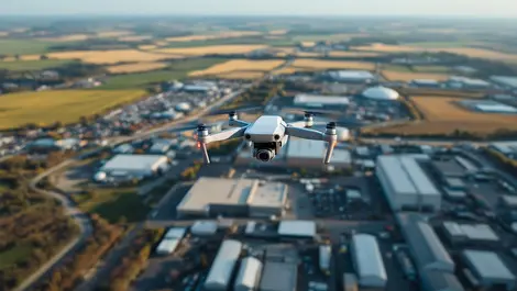
Commercial drone automation set to soar across industries
Last month
#
surveillance
#
edge computing
#
supply chain
A Forrester report finds 78% of automation leaders plan to implement aerial drone automation within a year, boosting efficiency across industries.

Osmose & Neara partner to enhance utility data accuracy
Thu, 27th Mar 2025
#
data analytics
#
lidar
#
predictive analytics
Osmose and Neara have partnered to enhance utilities' asset risk assessments, aiming for improved grid resilience and significant cost savings.

Orbbec unveils Gemini 335Le camera & Pulsar SL450 LiDAR
Fri, 21st Mar 2025
#
robots
#
supply chain
#
ai
Orbbec has launched two innovative products, the Gemini 335Le 3D camera and Pulsar SL450 LiDAR, enhancing AI and robotic vision technology offerings.

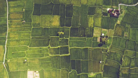
Drone GIS mapping market grows with tech advancements
Fri, 24th Jan 2025
#
construction
#
geographic information system
#
agriculture
The global drone GIS mapping market is poised for significant expansion, fuelled by technological advancements and increasing demand across diverse industries.

Ansys, Cognata & Microsoft join forces on ADAS testing
Tue, 7th Jan 2025
#
endpoint protection
#
edr
#
ai
Ansys has teamed up with Cognata and Microsoft to launch the Automated Driving Perception Hub on Azure, enhancing sensor testing for automotive ADAS and AV systems.

Unitec launches IoT Impact Lab for smart tech innovation
Thu, 5th Dec 2024
#
edutech
#
iot
#
ai
Unitec has launched an IoT Impact Lab to empower communities through IoT and AI, fostering innovation and career opportunities for students.
Carbonix partners with Toll to enhance drone operations in Australia
Wed, 2nd Oct 2024
#
drones
#
collaboration
#
uav
Carbonix has partnered with Toll Uncrewed Systems to bolster drone operations and training in Australia, enhancing capabilities across various sectors.

Heathrow enhances efficiency & security with Genetec solutions
Wed, 10th Jul 2024
#
firewalls
#
network security
#
physical security
Heathrow increases efficiency and security by quadrupling its Genetec deployment, now monitoring over 150 km of baggage belts and 150,000 vehicles daily.
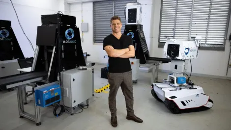
Australian tech firms spearhead mining efficiency & sustainability
Wed, 7th Feb 2024
#
ai
#
cleantech
#
sustainability
Small Australian tech firms, including innovators Plotlogic and global drone solutions, drive sustainable innovation and efficiency in global mining; key players in the industry's ‘race to net-zero’.

SA Power Networks completes world-first with extreme weather response
Thu, 11th May 2023
#
weather
#
aras
#
lidar
SA Power Networks has used state-of-the-art technology to inform, manage and accelerate its response to the River Murray flood event.

Neara launches a new automated LiDAR classification solution
Fri, 3rd Feb 2023
#
cleantech
#
productivity
#
sustainability
The new solution offers LiDAR (Light Detection and Ranging) based insights into critical infrastructure 30 times faster than manual processing.

Are solar panels a good investment? Auckland Uni answers
Fri, 13th Oct 2017
#
auckland university
#
auckland council
#
entrepreneur
We wanted to offer an educational tool that's impartial and realistic to help people work out if solar is economic for their workplaces.
Govt. puts $800,000 towards 3-D aerial mapping of Northland
Thu, 7th Sep 2017
#
3d
#
mapping
#
lidar
The data can be used by forestry companies to help plan their logging operations and horticulture companies for sustainable land management.